
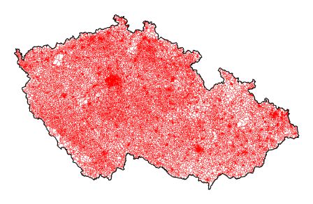
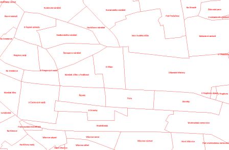
Basic settlement units - polygons


Basic characteristics
Name: Basic settlement unit - polygon (POLY_ZSJ);
Abstract: the layer contains the territorial delimitation of boundaries of basic settlement units specified in relation to the definition points of buildings; the map layer is also provided in a modification with the title *multi with associated attributes of the territory;
Reason of creation: territorial preparation of the Population and Housing Census 2001; the register update;
Origin: in 1999 - 2000 manual vectorization against a background of cadastral maps and the vector boundaries of cadastral districts from the ZABAGED 1 project (Basic map of the Czech Republic 1 : 10 000); topological-attribute derivation from the SO;
Extent / Completeness: territory of the state / 100 %;
Quality: balanced, topologically treated; see also time-laps metadata POLY_ZSJ 4.1.1.2. since 2001;
Number of simulated elements: 22 652 / 22 652;
Publication information
Data interpretation: basic settlement units express the structure of settlement of the Czech Republic, which is ideally composed into cadastral districts; in their territorial delimitation there might exist special phenomenons induced by the local situation; e.g. there was untypically delimited the basic settlement unit 32048 Číčovice in the Tábor district - this BSU is registered in this district, but it is territorially situated in the Písek district; the reason is the municipality part Číčovice situated in the Písek district, but registered in the municipality 549631 Nadějkov within the Tábor district;
Export and distribution formats: ArcView Shapefile, ArcInfo Coverage, ESRI Geodatabase (mdb);
Distribution units: arbitrary part of database according to the attribute or spatial selection;
Data source: Czech Statistical Office;
Commencement date: November 2002;
Effective date: 1 January 2020;
Last update: as per 10 January 2020;
Data statute: preparatory;
Legend: color (RGB) 255, 0, 0 - red unbroken line;
Note: -
Preview:
 ►►
►►
Metadata
Metadata author: Ing. Zdeňka Udržalová;
Commencement date: January 2003;
Last metadata update: 3 June 2020;
Spatial scheme
Element type: surface;
Element count: 22 652 (see Data interpretation);
Geometric model: lines / polygons; continuous plane graph;
Topology: yes (planar);
Spatial reference system
Projection coordinate system: S-JTSK_Krovak_East_North;
Geographic coordinate system: GCS_S_JTSK;
Accuracy
Positional: 0,5 - 5 m (map 1 : 1000 - 1 : 10 000);
Logical: definition points of buildings, polygons of statistical units;
Attribute scheme
The list of items:
KOD_ZSJ_P ... basic settlement unit code (dial 0047);
NAZ_ZSJ ... basic settlement unit name (dial 0047);
PORCUO ... urbanistic district serial number within the municipality (attribute code 548, dial 0047);
KOD_UTJ_P ... territorial technical unit code (dial 0052);
NAZ_UTJ_P ... territorial technical unit name (dial 0052);
KOD_KU_P ... cadastral district code (dial 0063);
NAZ_KU_P ... cadastral district name (dial 0063);
KOD_OBEC_P ... municipality unit code (dial 0043);
NAZ_OBEC_P ... municipality name (dial 0043);
KOD_ZUJ_P ... basic territorial code (dial 0052);
NAZ_ZUJ_P ... basic territoreal name (dial 0052);
LAU1_P ... district LAU 1 code (dial 0109);
KOD_OKRES ... district code (dial 0101);
NAZ_OKRES ... district name (dial 0101);
KOD_KRAJ ... region code (dial 0100);
NAZ_KRAJ ... region name (dial 0100);
NUTS3_KRAJ ... region code NUTS 3 Classification of Territorial Statistical Units CZ-NUTS (attribute code 42, dial 0100);
PLATIOD ... beginning of the time validity of ZSJ (date) (dial 0047);
NEPLATIPO ... end of the time validity of ZSJ (date) (dial 0047);
Multi1/ layer also contains other ZSJ attributes:
CHARAKTER_ZSJ ... the character of the basic settlement unit (attribute code 719, dial 0047);
MLZM10 ... ZM10 map sheet of the basic settlement unit (attribute code 60080, dial 0047);
POCADR ... number of addresses (attribute code 60088, dial 0047);
POCBUD ... number of buildings (attribute code 60083, dial 0047);
POCBUDBYT ... number of residential buildings (attribute code 60084, dial 0047);
POCBUDKRUB ... short-stay accommodation buildings (attribute code 60092, dial 0047);
PBUDCP ... number of buildings with house number (attribute code 60094, dial 0047);
POCBYT ... number of dwellings (attribute code 60085, dial 0047);
POCBYTOB ... number of dwelling unites inhabited (attribute code 60086, dial 0047);
POCOBYEV ... number of residents in the buldings (attribute code 60091, dial 0047);
POCOIR_ZSJ ... number of objects of individual recreation (attribute code 60087, dial 0047);
POCOBYSL01 ... number of residents in the buldings by Census 2001 (attribute code 60089, dial 0047);
POBYOSL11 ... number of residents in the buldings by Census 2011 - habitual residence (attribute code 60090, dial 0047);
POCOBYSL11 ...number of residents in the buldings by Census 2011 - permanent residence (attribute code 60093, dial 0047);
VYMERA ... area of the basic settlement unit (attribute code 60081, dial 0047);
1/ one territorial unit in a map corresponds to one sentence in the attached database (see also Methodology of support for the display of discontinuous territorial units in the GIS)
Language / character set: czech / win1250;


