
Streets and other public places - point


Basic characteristics
Name: Street and other public place - point (DB_UVP);
Abstract: the layer contains the localization of streets and other public places in the definition point form;
Reason of creation: territorial preparation of the Population and Housing Census 2001, 2011;
Origin: manual vectorization against a background of cadastral maps at every scale (decimal, fathom, inset); manual vectorization according to municipal documents; since 2011 – ZABAGED, since 2012 - public administration system Register of Territorial Identification, Addresses and Real Estate (both the State Administration of Land Surveying and Cadastre) and own statistical activities;
Extent / Completeness: territory of the state / 99,3 % of registered streets;
Quality: balanced; see also time-laps metadata UVP 3.1.2.2. since 2001;
Number of simulated elements: 83 382 / 82 991 (see Data interpretation);
Publication information
Data interpretation: the layer is not the image of state of descriptive records; the differences in element counts unwinds from the method of streets and public places naming in case of longer communications, on which more statistical units are situated, where more definition points with the same name of a street or a public place were created;
Export and distribution formats: by default ArcView Shapefile, ArcInfo Coverage, ESRI Geodatabase (mdb);
Distribution units: arbitrary part of database according to the attribute or spatial selection;
Data source: Czech Statistical Office;
Commencement date: November 2002;
Effective date: as per 1 January 2020;
Last update: 10 January 2020;
Update mode: continuous;
Data statute: production;
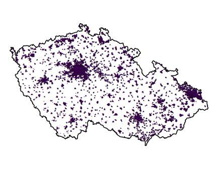
Legend: color (RGB) 76, 0, 115 - violet point;
Note: ---
Preview:
 ►►
►►
Metadata
Metadata author: Ing. Zdeňka Udržalová;
Commencement date: January 2003;
Last metadata update: 3 June 2020;
Spatial scheme
Element count: 183 917 (see Data interpretation);
Geometric model: points;
Topology: no;
Spatial reference system
Projection coordinate system: S-JTSK_Krovak_East_North;
Geographic coordinate system: GCS_S_JTSK;
Accuracy
Positional: x;
Logical: parcel, definition points of buildings;
Attribute scheme
The list of items:
ULICE_ID … unique identifier of a street within the CR - the public administration register RÚIAN (dial 0066);
NAZEV_UL_A … address name of a street and other public places (capital and small letters) (dial 0066);
KOD_OBEC … municipality code (dial 0043);
NAZ_OBEC … municipality name (dial 0043);
LAU1 … district code LAU 1 (attribute 43 dial 0101);
KOD_OKRES … district code (dial 0101);
NAZ_OKRES … district name (dial 0101);
KOD_KRAJ … region code (dial 0100);
NAZ_KRAJ … region name (dial 0100);
ZDROJ … source of localization;
ZMENA … update nature within the dataset:
11 ... new street and other public place
21 ... correction/localization precising
22 ... change of natural identification of an streetand other public place
23 ... correction/localization precising together with the change of natural identification
41 ... relocalization
61 ... street point with a semifinished statute - it is not a part of exports
69 ... pick-up of semifinished building (see nomenclature of changes)
91 ... without changes;
PLATIOD … beginning of the time validity of UVP (date) (dial 0066);
NEPLATIPO … end of the time validity of UVP (date) (dial 0066);
DAT_ZPRAC … time of data file proccesing;
ANGLE … angle of text orientation;
UL_JTSK_X … X coordinate of street and other public place (attributes 60260 dial 0066);
UL_JTSK_Y … Y coordinate of street and other public place (attributes 60260 dial 0066);
Language / character set: czech / win1250;


