
Statistical Yearbook of Prague - 2021
Maps and cartograms
Attachments
| Geographical map of the Capital City of Prague | PNG |
| Territorial expansion of Prague according to cadastral areas | PNG |
| Capital City of Prague – city sections and cadastral area | PNG |
| Administrative division of the Capital City of Prague according to Act No. 51/2020 Coll. (10 districts) | PNG |
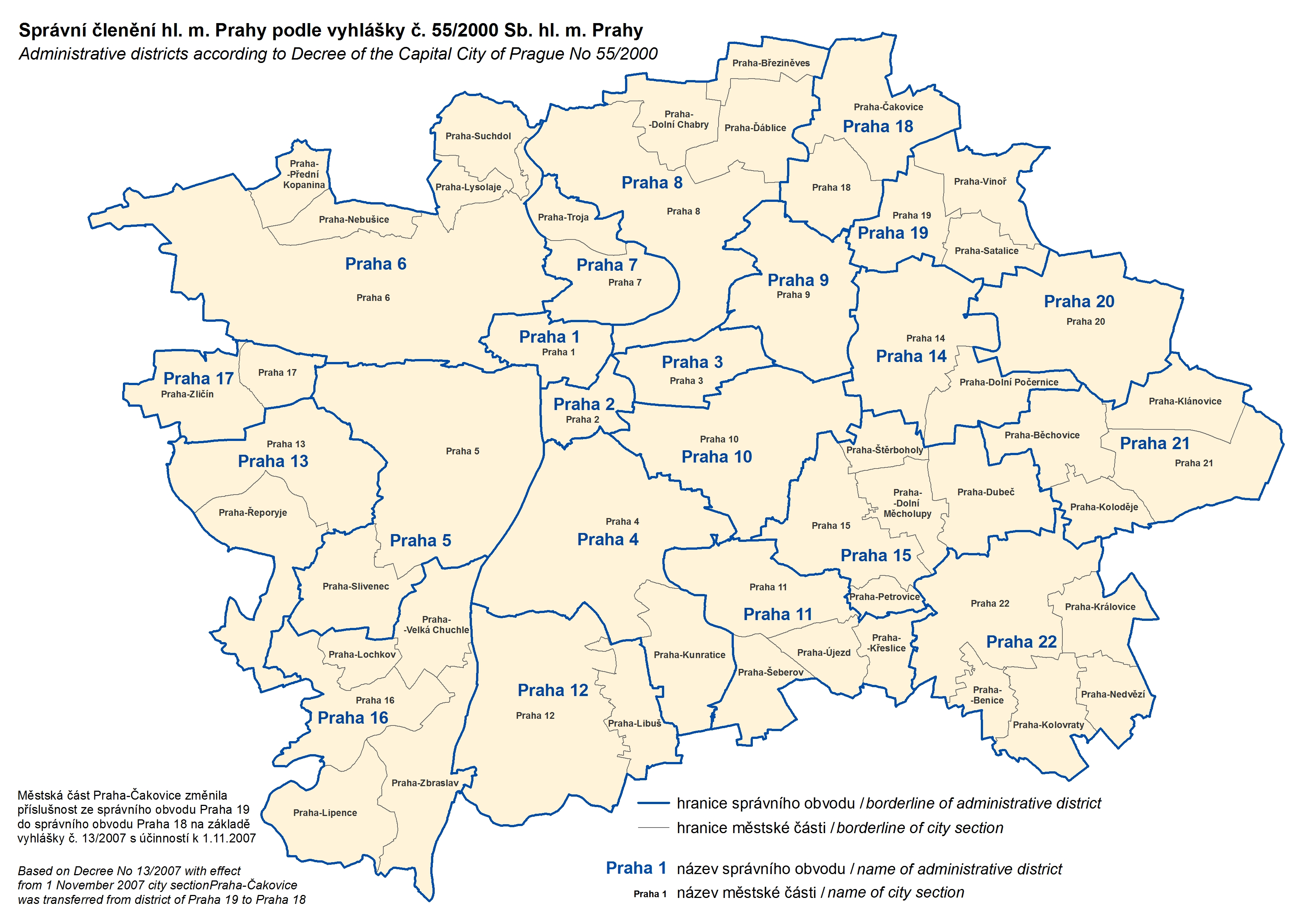
| Administrative breakdown of the Capital City of Prague according to Decree of the Capital City of Prague No. 55/2000 | PNG |
| Key and symbols on the geographical map of the Region | |
| Regions and districts – abbreviations | |
| 1. Natural population change in the Prague city sections in 2016–2020 | PNG |
| 2. Net migration in the Prague city sections in 2016–2020 | PNG |
| 3. Share of unemployed persons in the Prague city sections as at 31 December 2020 | PNG |
| 4. Completed dwellings in Prague city sections in 2001–2020 | PNG |
| 5. Water consumption in 2020 and the trend in water levies | PNG |
| 6. Live births in 2020 | PNG |
| 7. Deaths in 2015–2019 | PNG |
| 8. Deaths in 2020 | PNG |
| 9. Revenue and expenditure of local governments | PNG |
| 10. Participation rate of the population in 2020 | PNG |
| 11. Share of unemployed persons as at 31 December 2020 | PNG |
| 12. Average gross monthly wage in 2019 | PNG |
| 13. Private entrepreneurs with identified activity as at 31 December 2020 | PNG |
| 14. Organic farming | PNG |
| 15. Sales of goods and services incidental to industry in 2020 | PNG |
| 16. Net consumption of electricity in 2020 | PNG |
| 17. Guests in collective accommodation establishments in 2020 | PNG |
| 18. Foreign guests in collective accommodation establishments by country in 2020 | PNG |
| 19. Students in public and private universities by location of the place of permanent residence of a student in 2020 | PNG |
| 20. Disability badge holders as at December 2020 | PNG |
| 21. Disability badge holders aged under 18 years as at December 2020 | PNG |
| 22. Traffic accidents caused by wrong overtaking in 2020 | PNG |
Published: 20.12.2021
The data are valid as of the release date of the publication.


