
Municipalities of the Královéhradecký Region - 2023
Cartograms
Attachments
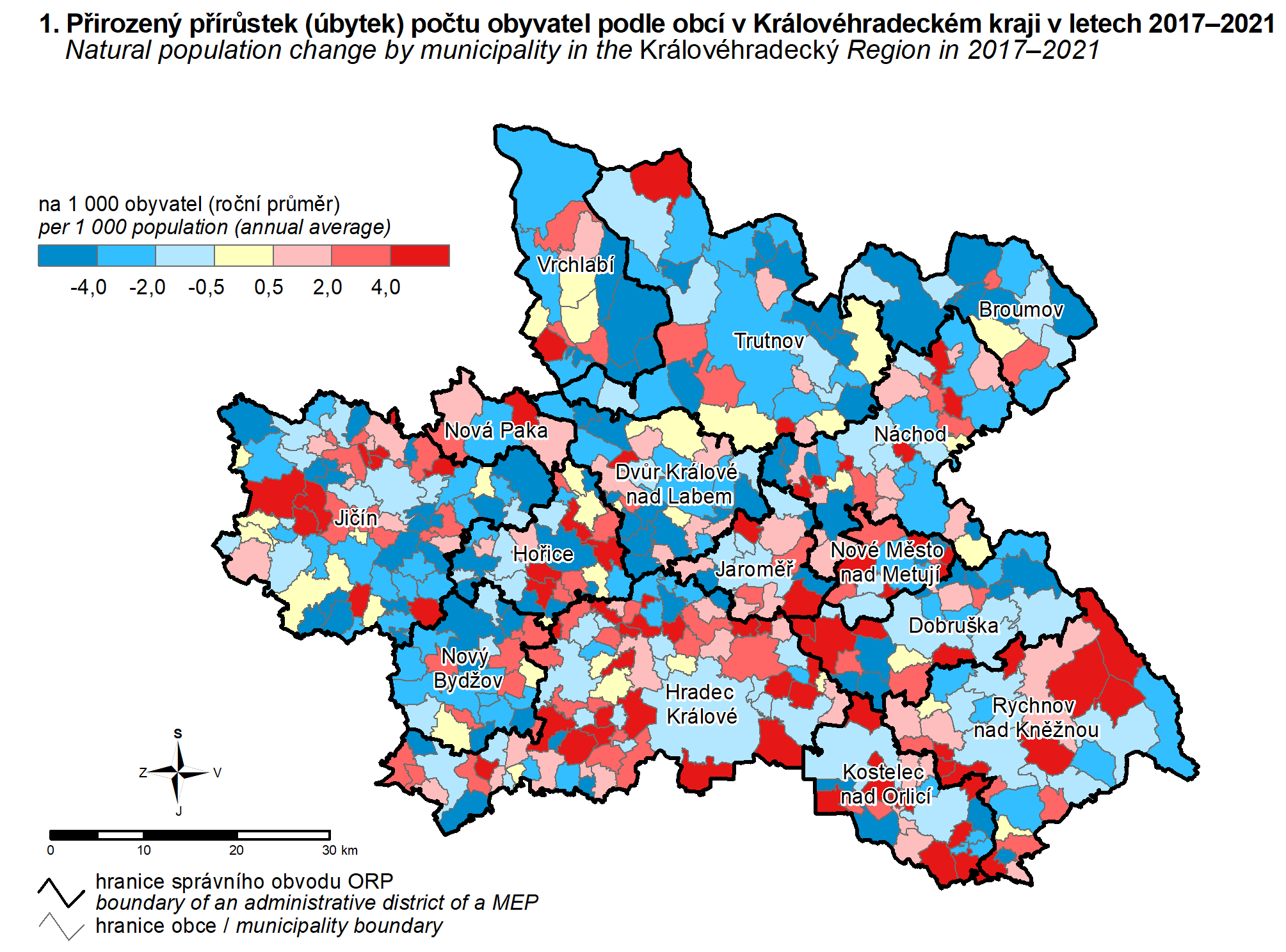
| 1. Natural population change by municipality in the Královéhradecký Region in 2017–2021 | PNG |
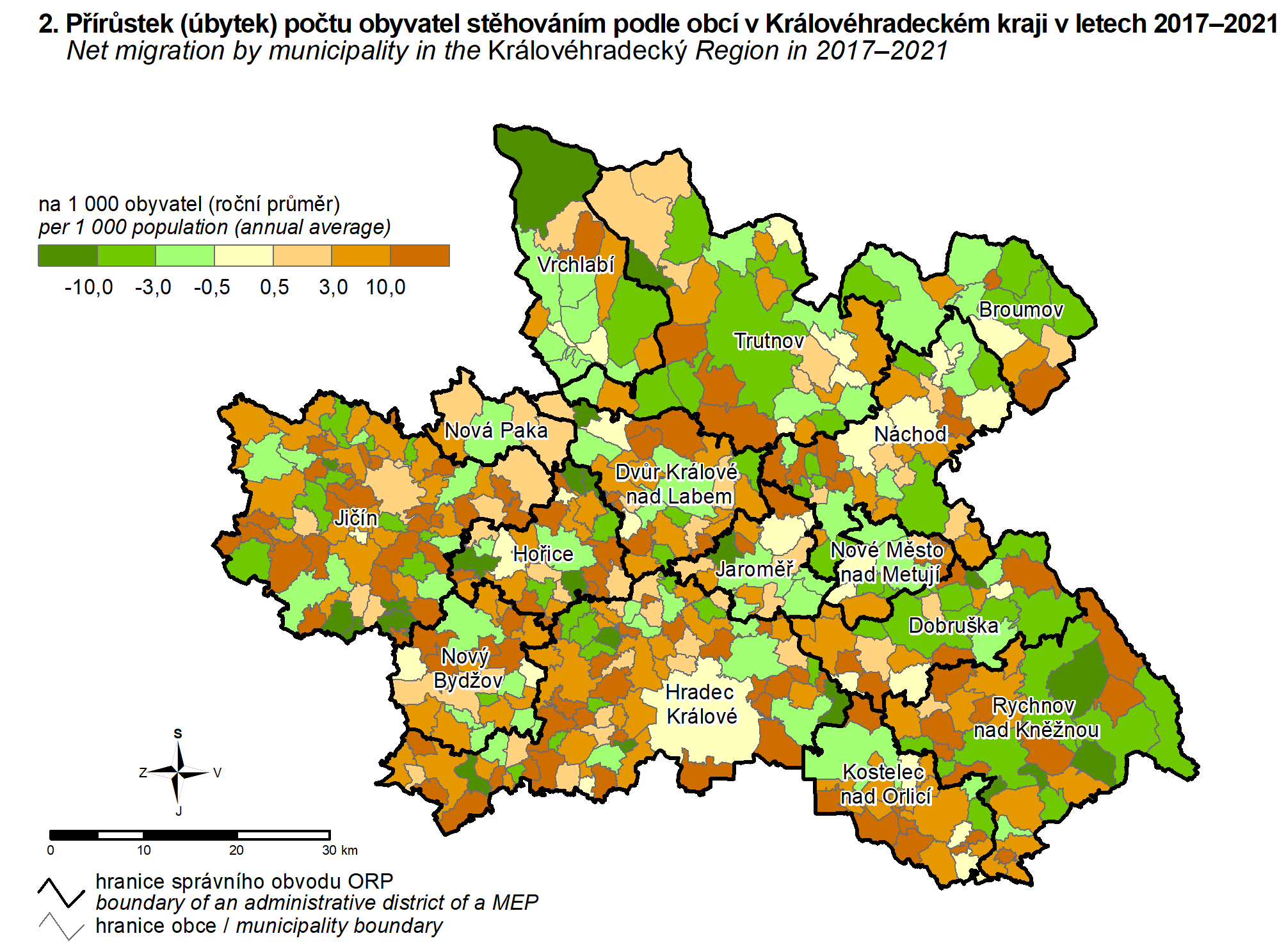
| 2. Net migration by municipality in the Královéhradecký Region in 2017–2021 | PNG |
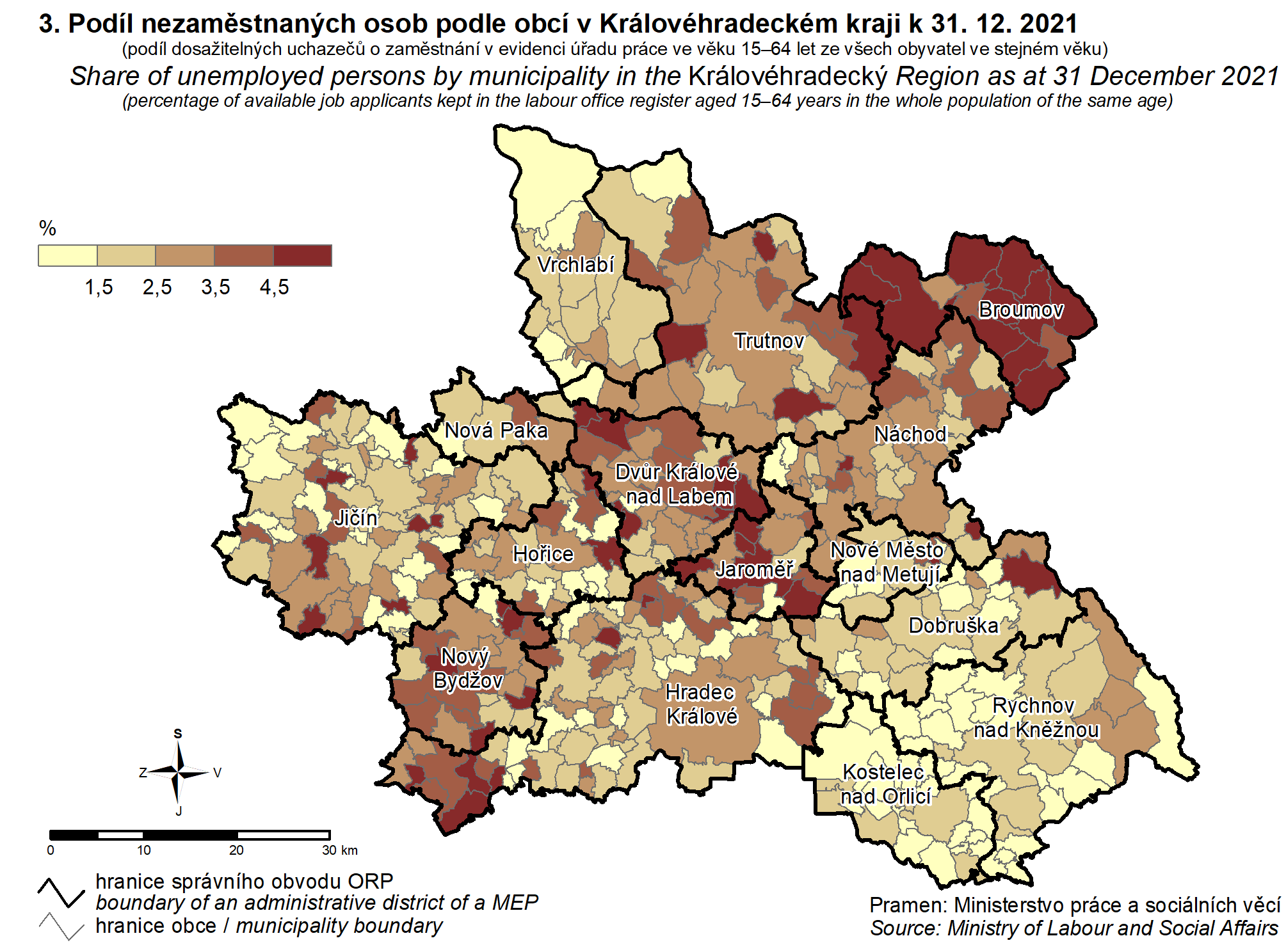
| 3. Share of unemployed persons by municipality in the Královéhradecký Region as at 31 December 2021 | PNG |
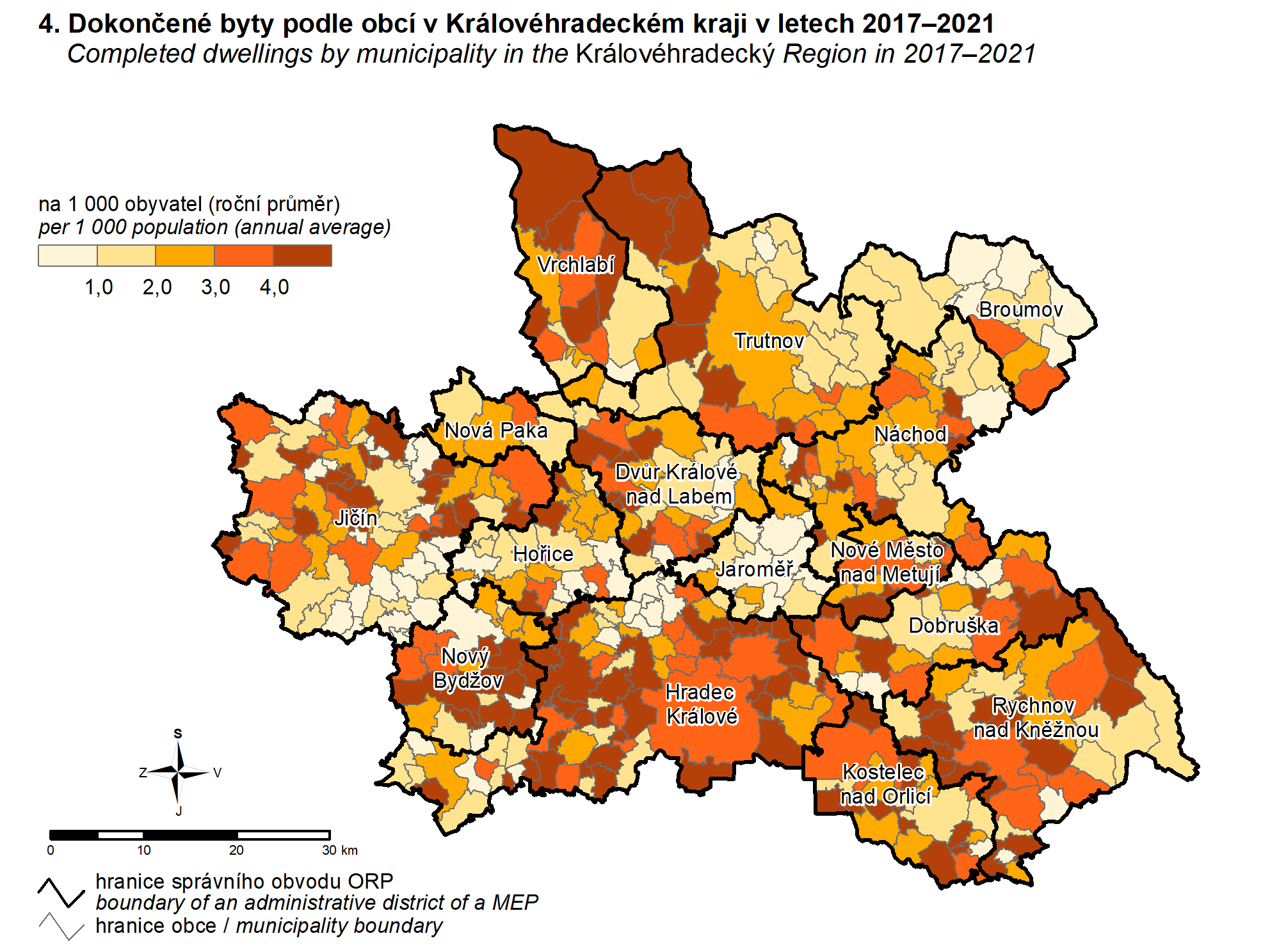
| 4. Completed dwellings by municipality in the Královéhradecký Region in 2017–2021 | PNG |
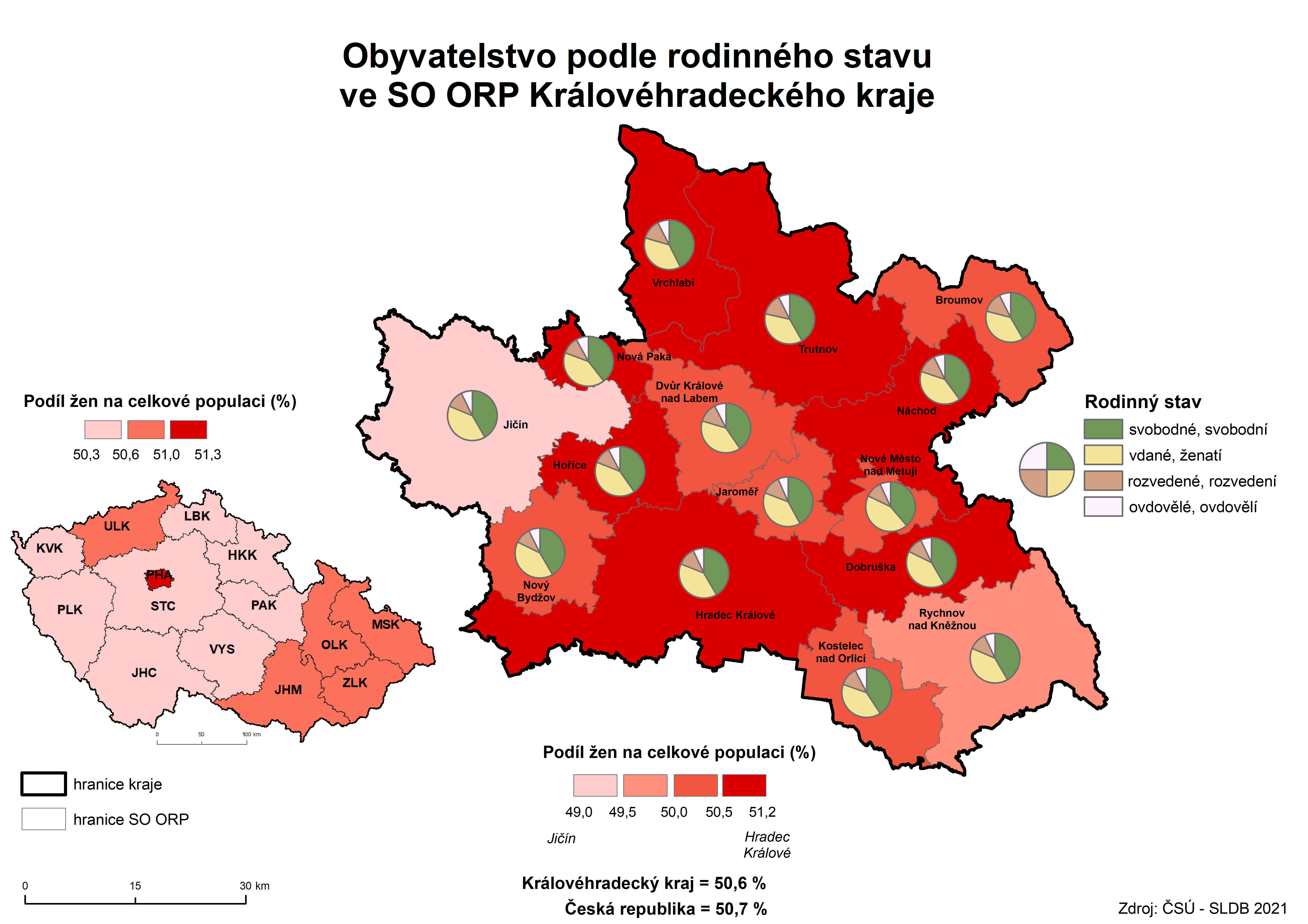
| 5. Population by marital statues in AD MEP of the Královéhradecký Region (PHC 2021) | PNG |
| 6. Population by place of residence at birth in municipality of usualy residence in AD MEP of the Královéhradecký Region (PHC 2021) | PNG |
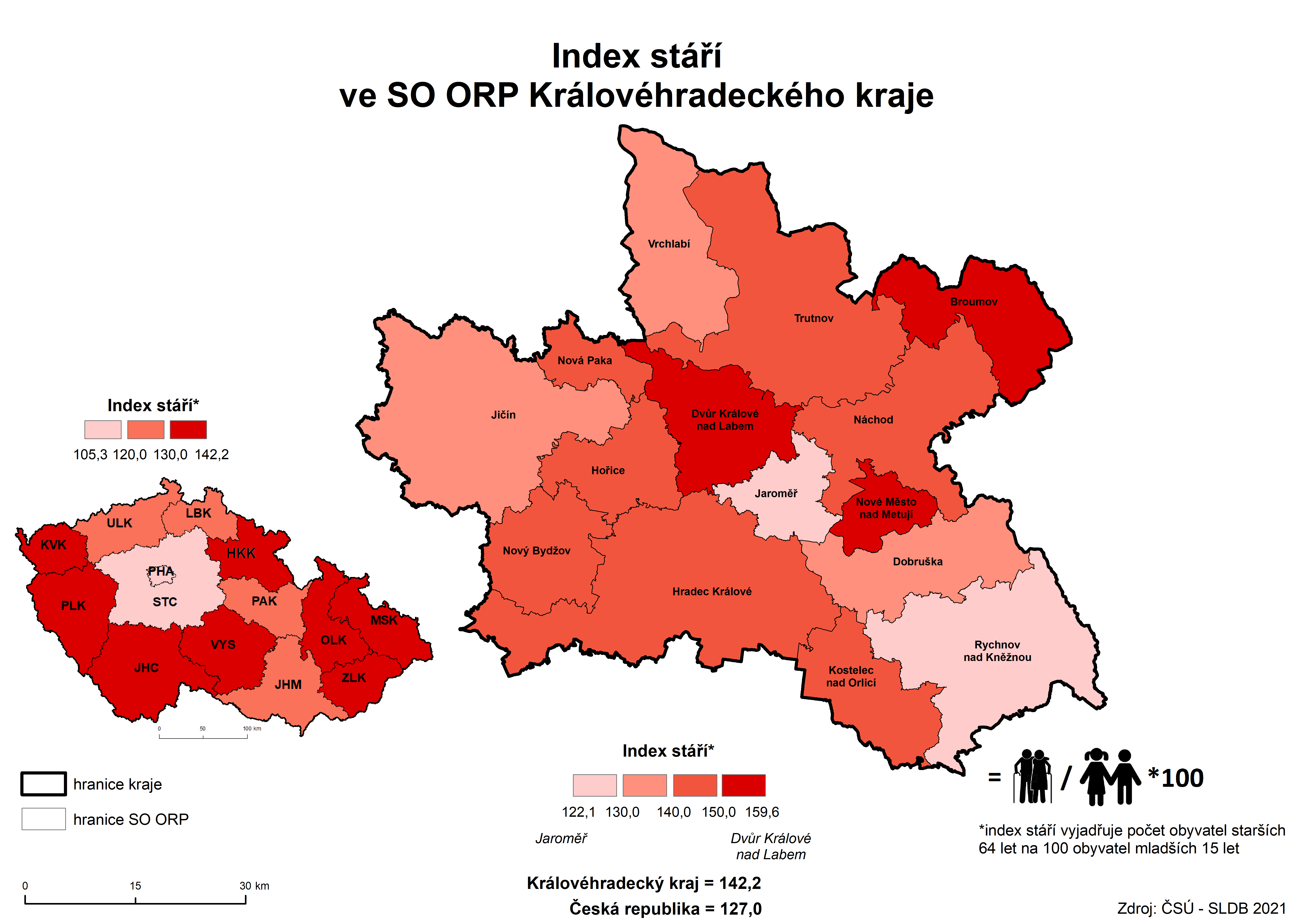
| 7. Age index of population in AD MEP of the Královéhradecký Region (PHC 2021) | PNG |
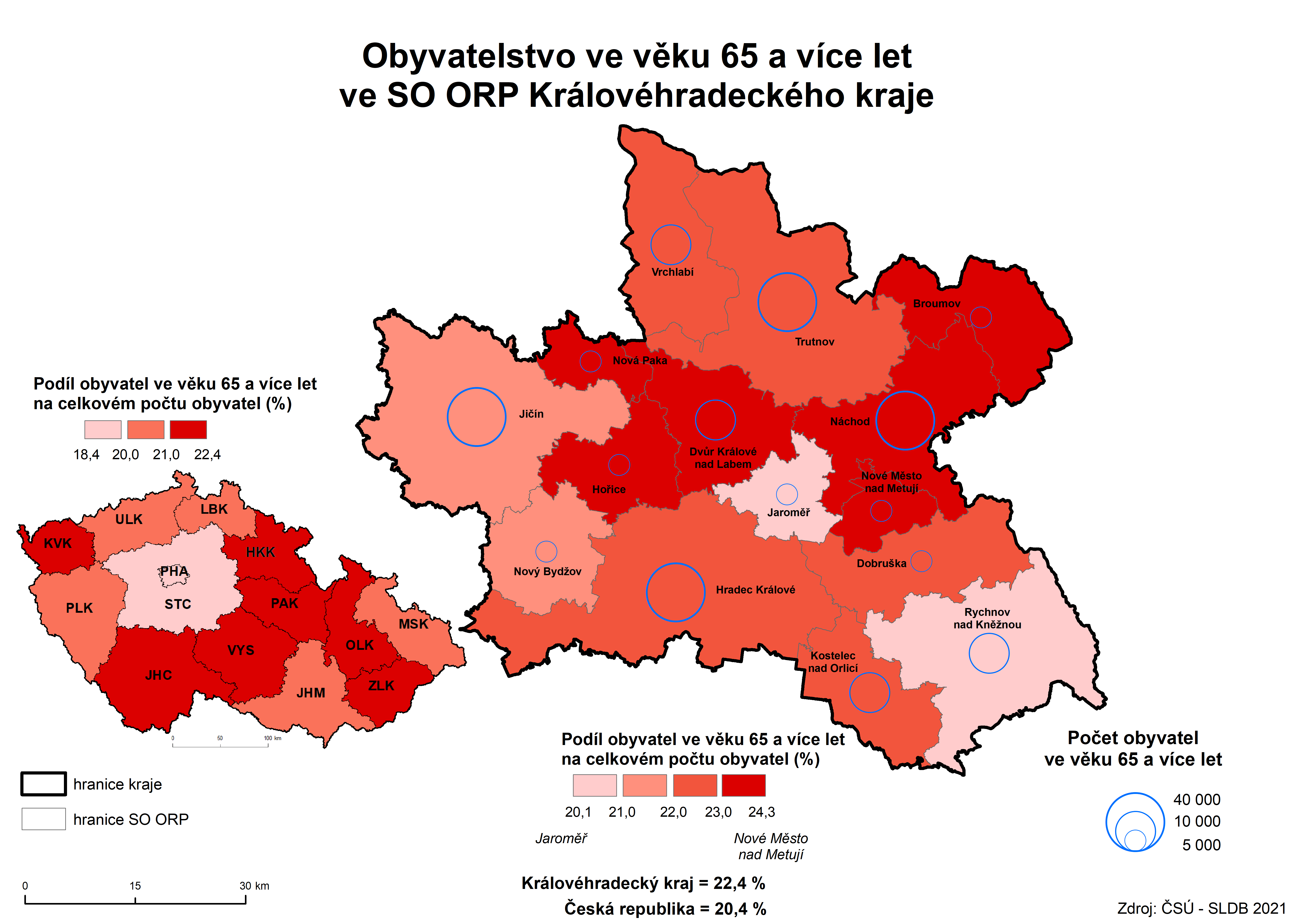
| 8. Population aged 65+ in AD MEP of the Královéhradecký Region (PHC 2021) | PNG |
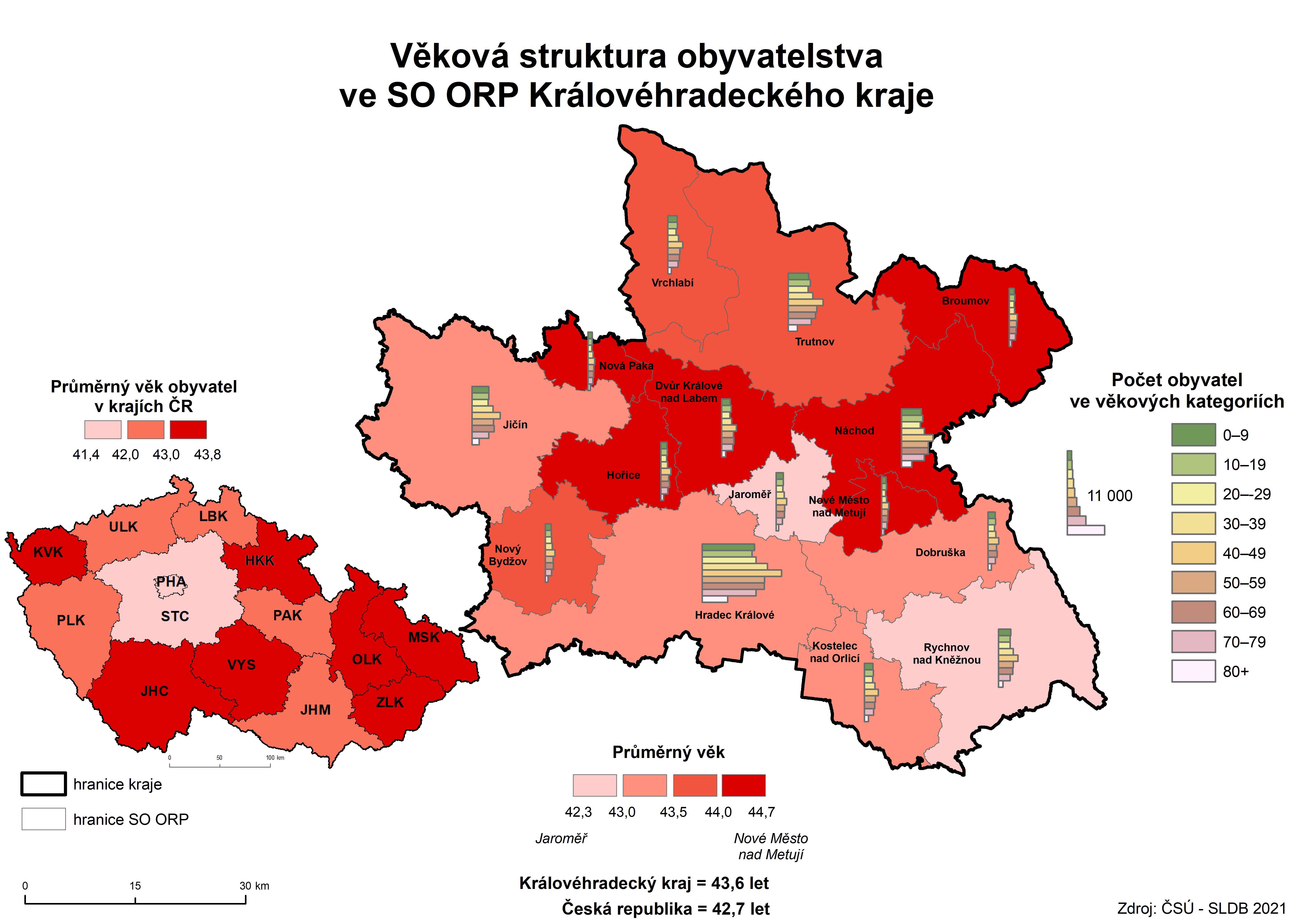
| 9. Population by age in AD MEP of the Královéhradecký Region (PHC 2021) | PNG |
| 10. Houses by occupancy status in AD MEP of the Královéhradecký Region (PHC 2021) | PNG |
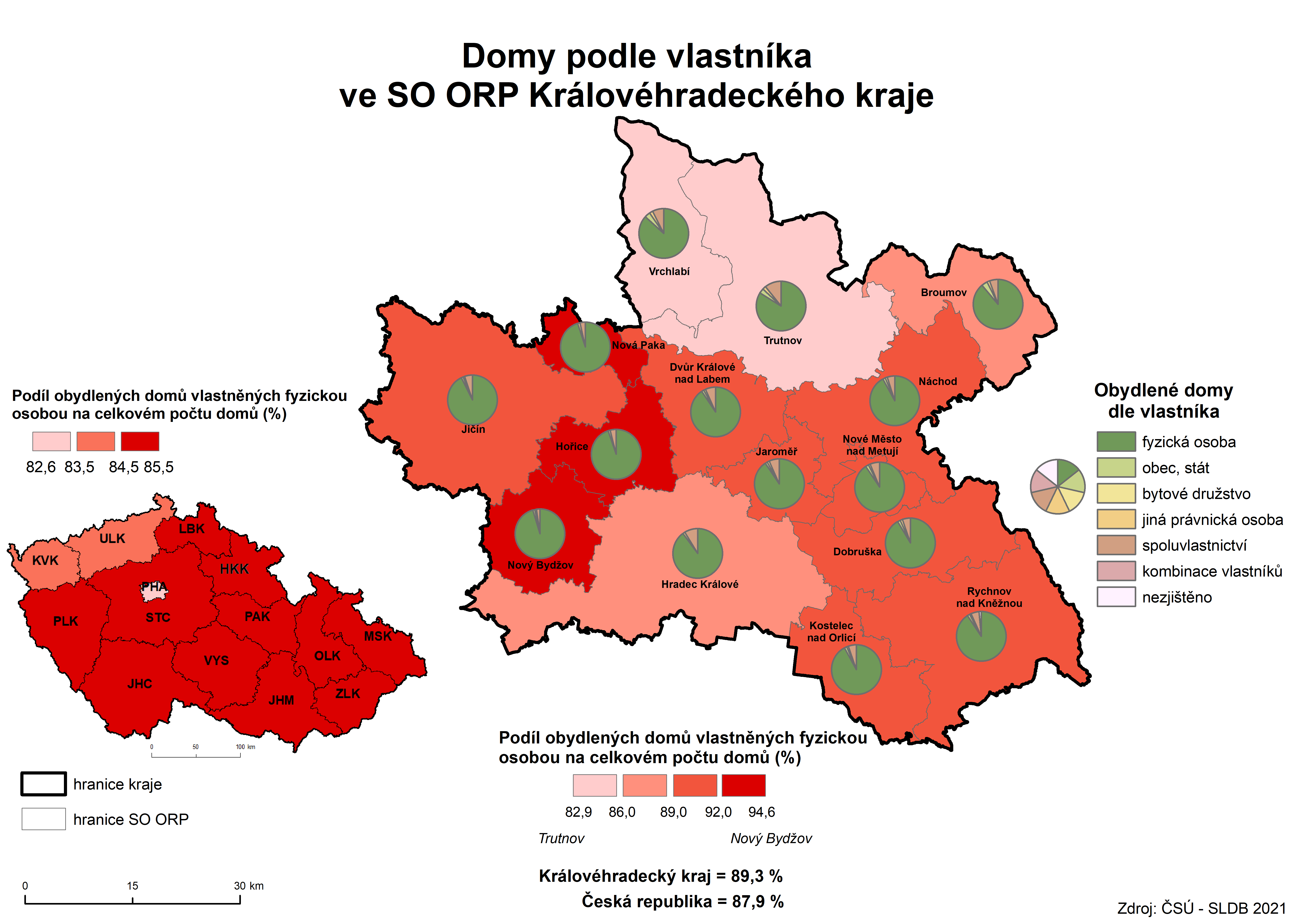
| 11. Occupied houses by tenure status in AD MEP of the Královéhradecký Region (PHC 2021) | PNG |
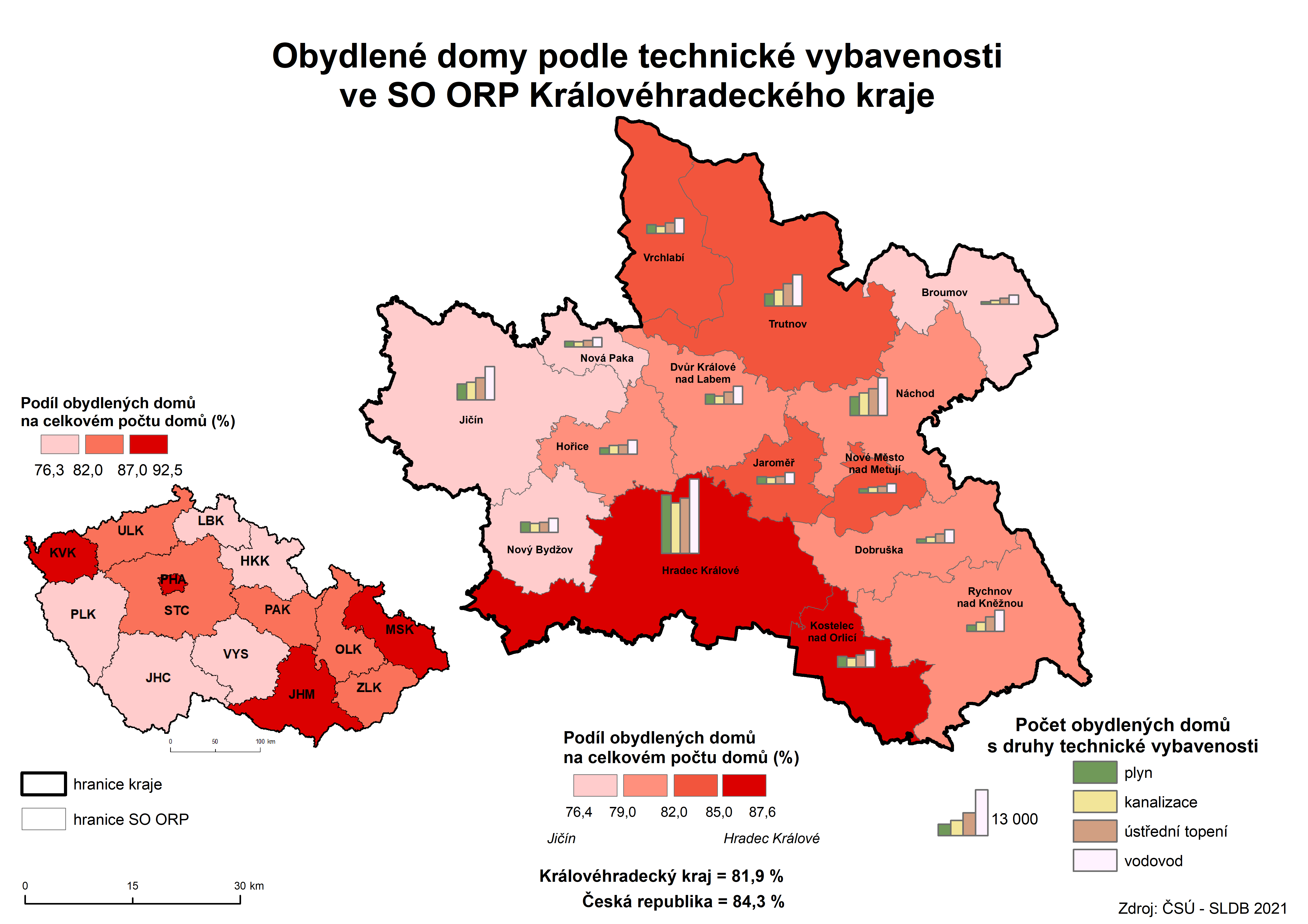
| 12. Occupied houses by technical facilities in AD MEP of the Královéhradecký Region (PHC 2021) | PNG |
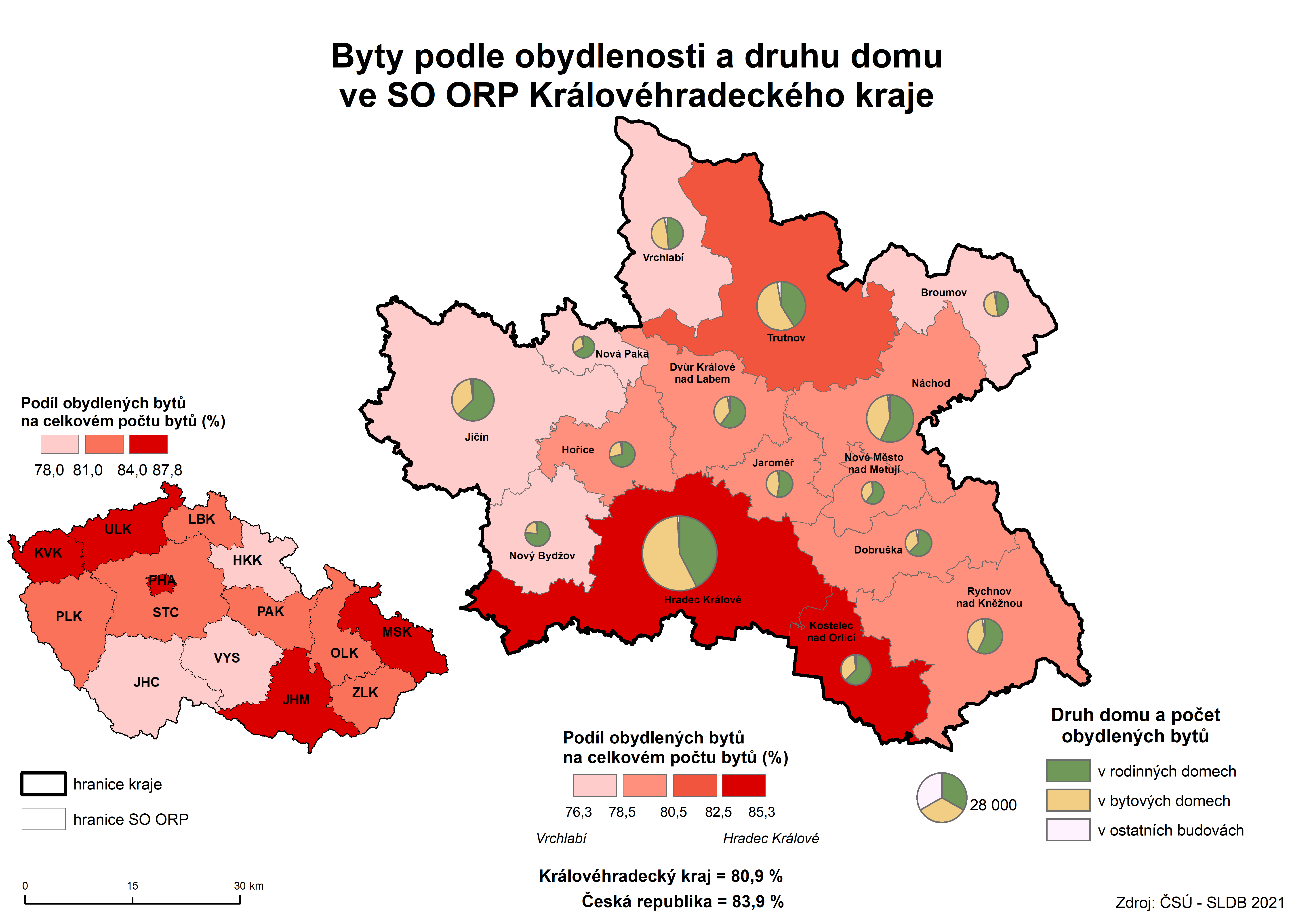
| 13. Dwellings by occupancy status in AD MEP of the Královéhradecký Region (PHC 2021) | PNG |
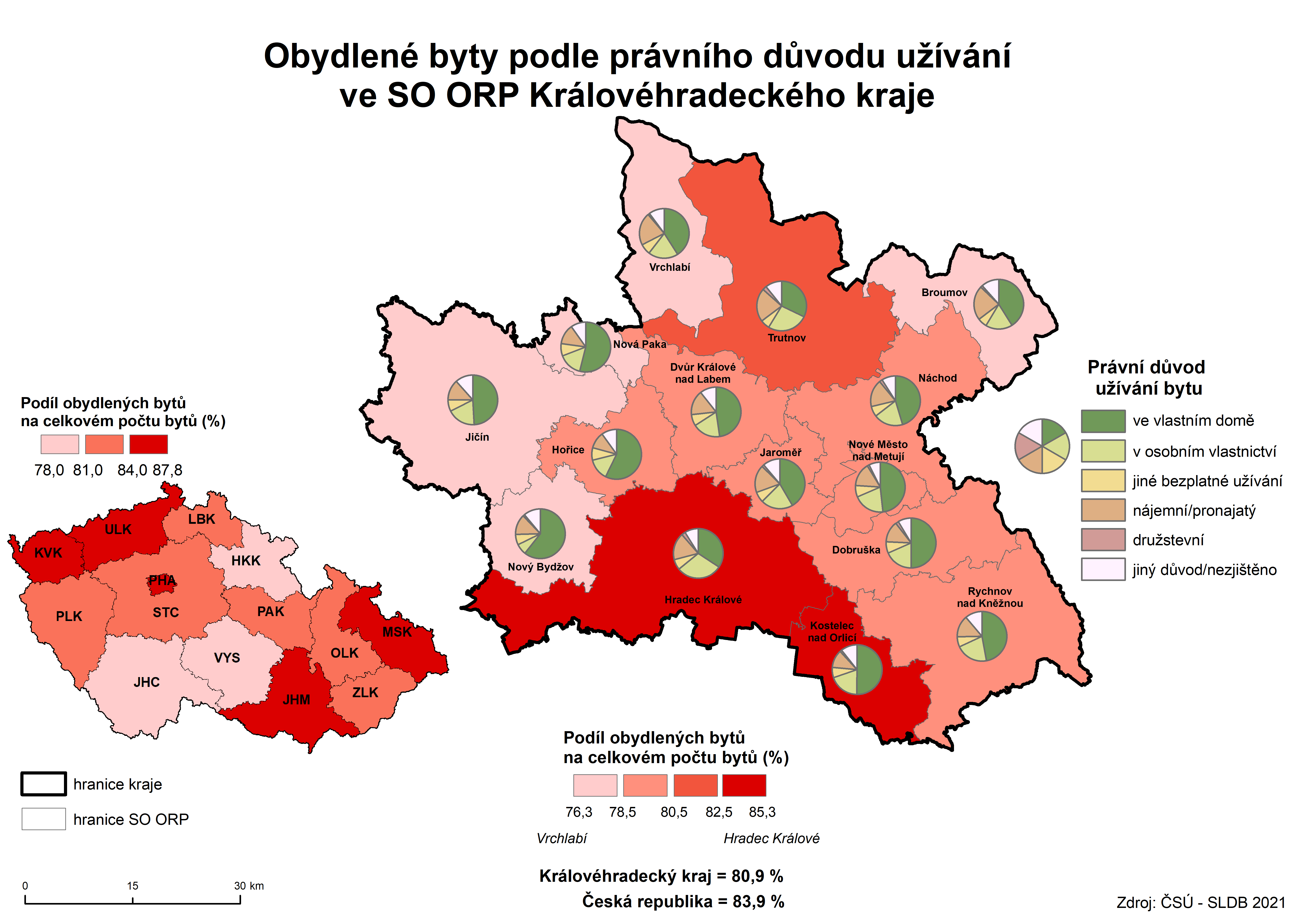
| 14. Occupied dwellings by tenure status in AD MEP of the Královéhradecký Region (PHC 2021) | PNG |
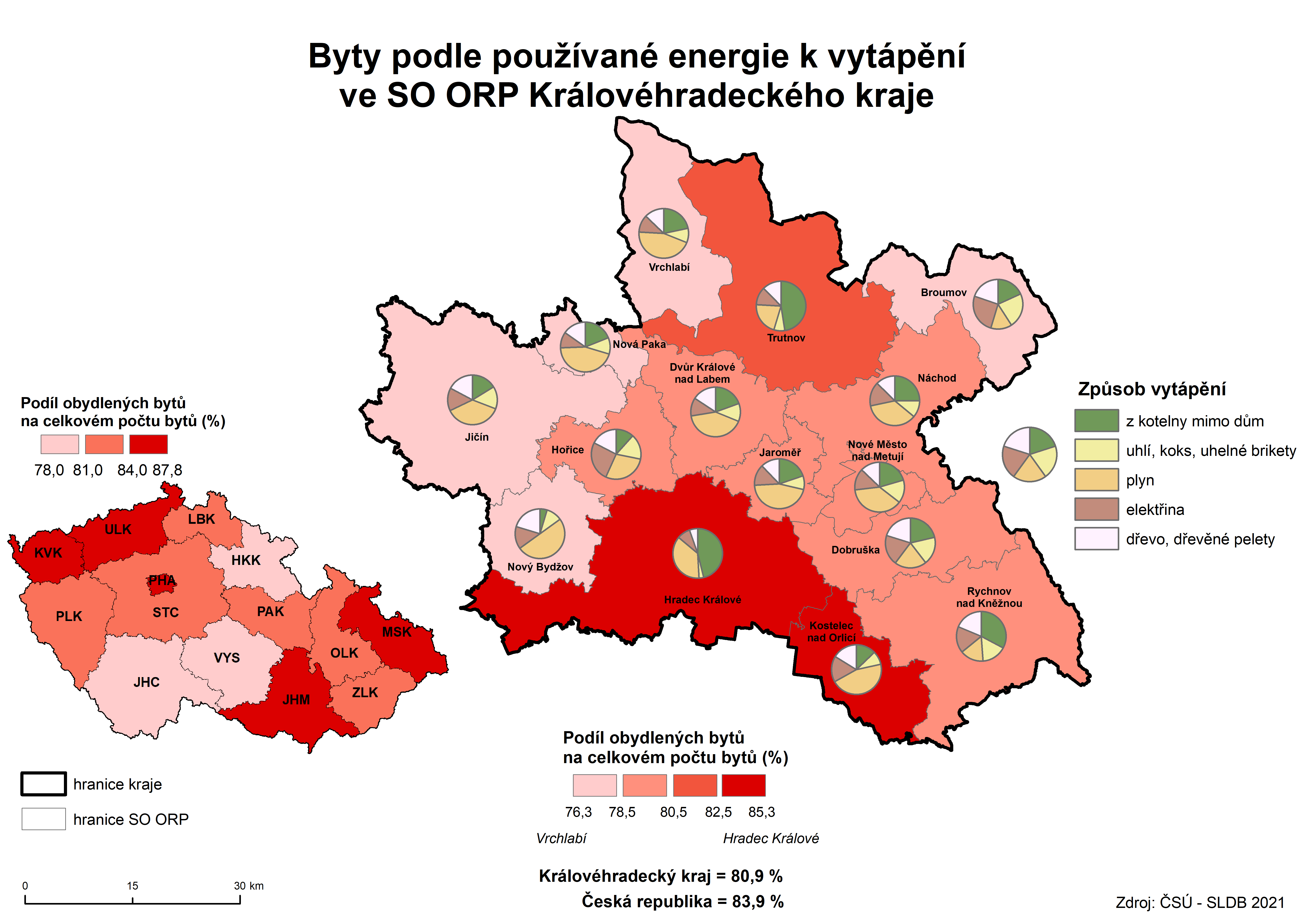
| 15. Occupied dwellings by type of energy used for heating in AD MEP of the Královéhradecký Region (PHC 2021) | PNG |
Published: 31.03.2023
The data are valid as of the release date of the publication.


